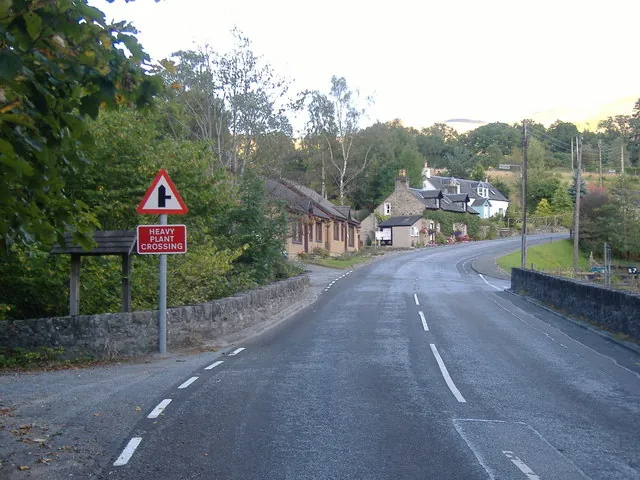
Killiecrankie is a village in Perth and Kinross on the River Garry, at the pass that carries its name. The Gaelic form, Coille Chreithnich, means “aspen wood”. It is the short trip north out of Pitlochry, and the reason to make it is that two very different things occupy one stretch of gorge: a battle in 1689 that was over in ten minutes and left a story about a soldier jumping the river, and, from the bridge above that water today, a bungee rope.
The straight-line distance from Pitlochry is 5.2 km. The village lies by the A9, which has been bypassed since 1986, and much of the riverbank belongs to the National Trust for Scotland, which runs the visitor centre at the pass. A power station here forms part of the Tummel Hydro-Electric Power Scheme.
It is a small place, and most of what a visitor does is on foot between the car park, the wooded slope and the river.
The Soldier’s Leap is the point most people come for: where the Garry narrows enough that a fleeing soldier is said to have crossed it. It holds 4.5 from 353 Google reviews. The Pass of Killiecrankie is separately listed at 4.3 from 11 reviews, too few to read anything into.
The Pass of Killiecrankie National Trust Visitor Centre, 4.5 from 89 Google reviews, sits at the top of the path, with the Jacobite Café at 4.4 from 647. The café draws steadier praise than the rock. A visitor in June 2026 wrote of having “soup and a sandwich whilst watching the birds at the outside feeder, as well as a wee mouse.”
Two practical warnings come out of the reviews. The path down to the river is steep and can be greasy: a visitor in March 2026 advised that “The walk down can be slippery so make sure and have sutable footware”, and added that it is “not ideal for wheel chairs but the cafe onsite provides a great vantage point for the forest”. The second is the parking. The National Trust charges to park at the centre, and not everyone thinks the walk justifies it — a visitor in August 2025 called the Leap “a big rock in a river” and suggested you “consider parking elsewhere and walking TO it.” That same reviewer noted the Leap is only minutes from the café, which is the honest summary: the set piece is brief, the riverside walking around it is the substance.
Garry Bridge, high over the same gorge, is the other reason people stop, and at 4.7 from 604 Google reviews it draws the most ratings here. Highland Fling Bungee operates from it and carries 4.8 from 506 Google reviews; a second listing, Bungee Jump Scotland, shows 4.8 from only four reviews. Killiecrankie Zip Park runs alongside at 4.7 from 50.
Reviewers of the bungee are consistent about the briefing rather than the drop. A visitor in July 2026 described “Really clear safety checks and multiple team members confirming checks were completed”, and that “It also helps that the staff talk you through what is being done (harness adjustments etc).” Another that month, jumping alone: “I was a bit nervous at first but the team encouraged me and I will never regret trying it out.”
You do not have to jump to make the bridge worth walking onto. A visitor in June 2026 called it a “Great viewing area for any friends or relatives daring the bungee jump or swing from the bridge”, so the swing and the jump can both be watched from the deck. The bridge is also a walking start: a visitor in July 2026 described a circular route from it around the Tummel as an “Easy 11km walk”, during which they “Watched some folks bungee-ing and zip-lining.”
The Battle of Killiecrankie was fought in 1689, during the Jacobite Rebellion, on the northern edge of the village. The Highland charge took the government forces under General Hugh MacKay by surprise and overwhelmed them in ten minutes. John Graham of Claverhouse, Viscount Dundee, one of the rebellion’s best-known leaders, was killed in it.
The Leap belongs to the losing side. Donald MacBean, a supporter of William II of Scotland, is said to have cleared the pass from one bank to the other as he got away. A Memorial Field to the fallen lies within the grounds of Urrard House, which is category B listed.
The battle stayed in the culture longer than it took to fight. Walter Scott referenced it in his 1816 novel Old Mortality, and the folk song “Braes o’ Killiecrankie” commemorates it; a 1966 recording by The Corries was an early use of the music video. The village later stood in for Highland music more broadly when the BBC Four series The Highland Sessions, presented by Mary Ann Kennedy, was filmed here with Scottish and Irish musicians.
One more date is worth carrying up the path: official records put the killing of the last wolf in Great Britain near Killiecrankie in 1680, nine years before the battle.
The ten-arch railway viaduct runs for 109 yards (100 m) along the north-east bank of the Garry. It was built in 1863 to a design by Joseph Mitchell, and is listed as a historical landmark at 4.8 from nine Google reviews, far too small a sample to mean much.
The power station is the other piece of engineering, part of the Tummel Hydro-Electric Power Scheme. For eating beyond the café, Killiecrankie House is a fine dining restaurant rated 4.9 from 191 Google reviews.
Killiecrankie sits by the A9, which since 1986 has bypassed the village rather than run through it, so the traffic that once passed the door now goes round. Between the two, on Killiecrankie Road out of Pitlochry, is Faskally Woods Holiday Park, 2.9 km from the town and 4.5 from 807 Google reviews.
The material available here establishes no scheduled bus or train service between Pitlochry and Killiecrankie: assume you are driving, cycling or walking, and check locally before relying on public transport. If you drive, the National Trust car park at the visitor centre is the obvious place to leave the car, with the caveat above that it is charged and that some reviewers prefer to park away from it and walk in along the river.
The village and what is around it, at walking scale.
Open any of them in Google Maps for directions and current opening.
Attractions, prices and availability in Pitlochry
These come from GetYourGuide's booking widget, which sets their cookies in your browser. Consent to load it and see the attractions and prices.
Background on Killiecrankie draws on its Wikipedia article, text there being available under CC BY-SA 4.0.